Larnaca Harbour: What's on the Waterfront and How to See It
Larnaca harbour is a small working waterfront backed by the fort and promenade. Here is what sits on the quayside, how long the walk takes and when to go.
On this page
Larnaca harbour is a small working waterfront at the south end of the town centre, with the marina berths alongside and the fort standing directly above the quay. It is not a beach: the town's swimming is at Phinikoudes and Mackenzie, while the harbour is where you come to walk, look at boats and use the waterfront as the start of a circuit through the old town. This guide covers what sits on the quayside, how long the walk takes, where the boats go and when the light and heat work in your favour.
What Larnaca harbour actually is
The harbour is a compact, walk-first place rather than a sight with a turnstile. The marina sits alongside it as a boating base, and the whole thing reads as one continuous edge between the town and the water, with the fort as the landmark that tells you where you are. This is one of the easiest things to do in Larnaca because it needs no ticket and no planning, and it slots into a morning or an evening rather than consuming a day.
Its scale is the point. You are not crossing a port complex or hunting for an entrance; the waterfront begins where the town's streets meet the sea, and the marina berths are visible from the quay itself. That makes it a natural hinge for a half-day: walk the harbour edge, climb to the fort, then head into the parallel streets of the Larnaca old town for the rest of the morning.
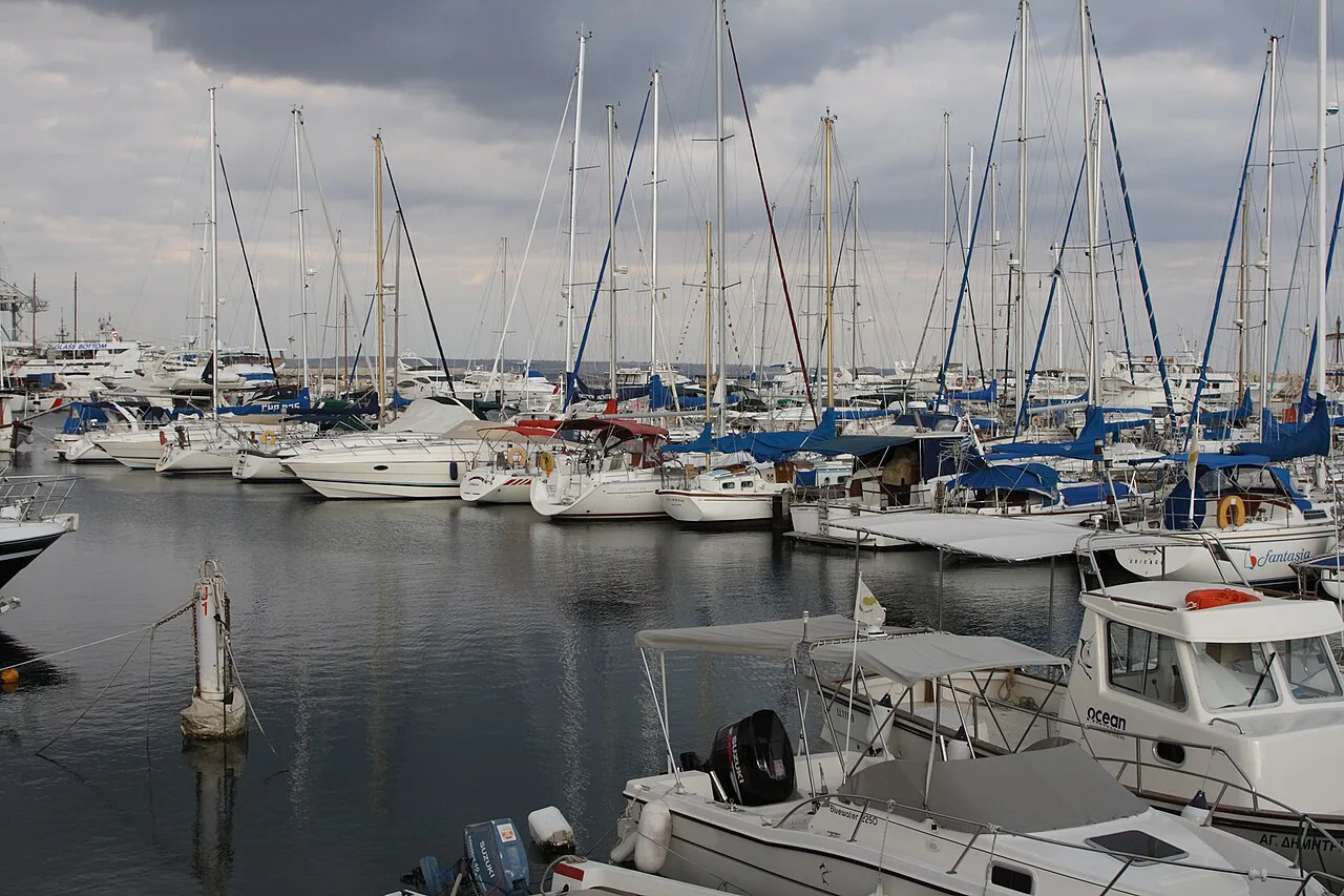
Where the harbour sits in Larnaca
The harbour occupies the town-centre waterfront, with the fort on its northern shoulder and the open water of Larnaka Bay beyond. Inland, the streets rise gently into the commercial centre; south and west, the coastline runs out towards the salt lake, the old airport area and the villages of Meneou and Pervolia. That geography matters when you plan a walk, because the harbour is the point where the town centre, the fort and the wetland beyond all connect on foot.
Because everything sits close together, the harbour works best as the anchor of a single loop rather than a separate trip. Arrive on foot, orient yourself by the fort, then decide whether to go inland into the lanes or south along the water. A Larnaca map helps here: the waterfront geometry is simple once you can see that the town centre, the fort and the salt lake lie in a rough line from north to south.
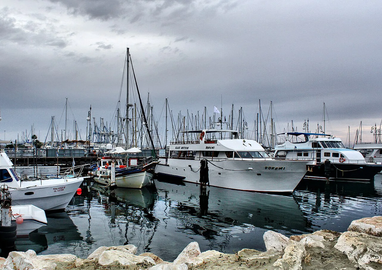
The waterfront walk: quayside, promenade and how long to allow
Allow about an hour for the harbour edge and the fort on foot, and two hours if you push on along the promenade and back through the old town. The quay itself is short; the walking is extended by adding the promenade and the lanes behind it. Go early or late, because the exposed quayside has very little shade and the middle of a summer day turns a pleasant stroll into a hot one. The Larnaca promenade continues the waterfront beyond the harbour, so you can stretch the route without needing transport.
If you want the whole picture rather than just the harbour, the Finikoudes promenade is the natural continuation: a palm-lined seafront stretch that links the town beach with the harbour end of things. Build the route so the harbour is your turning point, not your whole outing. A self-guided walking tour format suits this area well, since the interest is in the layout and the sightlines rather than in any single exhibit.
The fort above the harbour
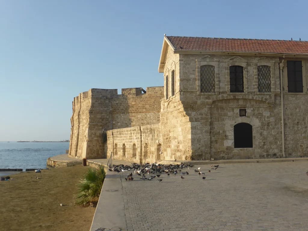
The fort is the harbour's vertical landmark, sitting on the waterfront so that you pass it whether or not you go inside. Its position is what makes the walk legible: from the quay you can see the whole arrangement of town, fort and water in one look. Plan the fort as a stop on the route rather than a separate excursion, and check current opening arrangements before you build a day around going in.
The Archaeological Museum of the Larnaka District, on Plateia Kalograion, is free to enter and opens Tuesday to Sunday, 9:00 to 16:30, closing on public holidays. It holds finds from the ancient city-kingdom of Kition and the Neolithic settlements of Choirokoitia and Tenta-Kalavasos, which makes it a sensible hot-hours companion to a harbour walk. It is a short walk inland from the quay, so it fits between the waterfront and the old-town lanes.
Pairing the harbour with Choirokoitia
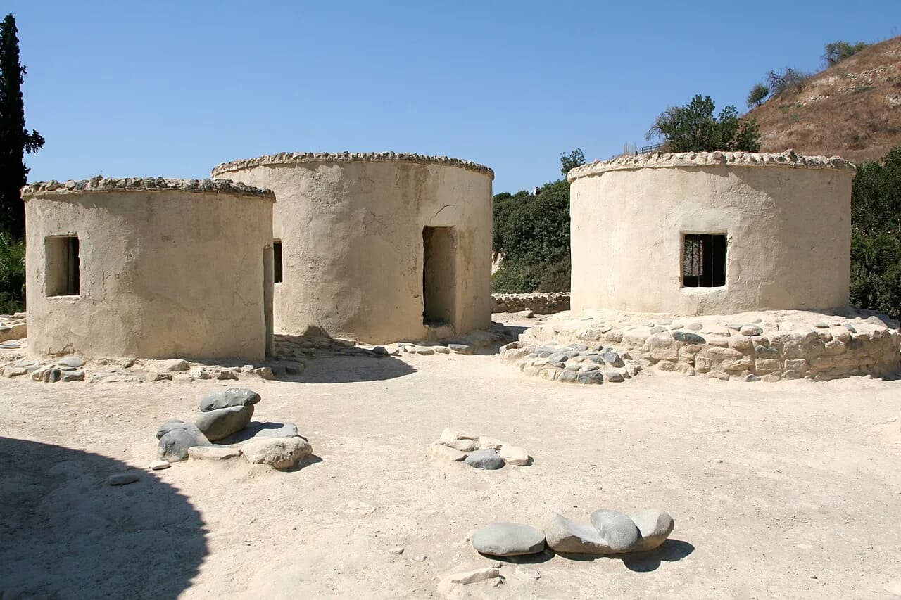
Choirokoitia, the Neolithic settlement 32 km from Larnaca on the Nicosia–Limassol motorway, is a UNESCO World Heritage Site with reconstructed cylindrical dwellings. It opens daily from 08:30 to 17:00 between 16 September and 15 April, and to 19:30 from 16 April to 15 September, with a 2,50 euro entrance fee. The site is not walkable from the harbour, so treat it as a separate half-day by car.
Boats on the water: the marina berths
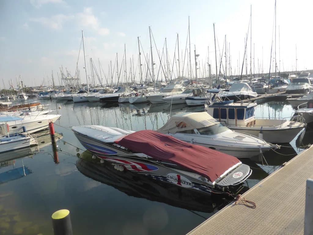
The marina runs alongside the harbour as a base for private boats and yachts, and the berths are part of the view from the quay rather than a gated attraction. Walk the edge and you see the mix of hulls that makes the waterfront feel used rather than staged. If you want the marina in more detail, Larnaca marina has its own guide, and Larnaca boat trips covers what leaves the town and how to choose between options.
Book any trip through the operator rather than assuming a departure point or a schedule from the quay. What runs, when it runs and what it costs are commercial decisions that change with the season.
The Zenobia: the harbour's headline dive
The Zenobia is the reason many divers come to Larnaca at all, and the boat for it leaves from the town's waterfront rather than the diving being in the harbour itself. The Swedish ferry capsized on her maiden voyage on 7 June 1980 and now lies on her port side in Larnaka Bay, 3.7 km from shore. She is 172 metres long, with a maximum depth of 42 metres and a shallowest point at 18 metres, and visibility in good conditions can reach 30 metres. Currents are low year-round, which widens the range of qualified divers who can enjoy the site, but the Larnaca Region authority rates it for Advanced Open Water level and above.
The wreck is also a marine protected area, with no fishing within three miles, so the marine life is unusually rich: dusky groupers, barracuda, moray eels, turtles and corals all appear among the cargo of lorries and trucks still on board. Water temperature ranges from about 15 to 28 degrees Celsius across the year. Plan on multiple dives if you want to see the whole ship, and book with the dive operator rather than the harbour, since the site itself is offshore.
When to go: winter light, summer heat and flamingo season
The quayside has little shade, so timing matters more here than at the beaches. In summer, walk it before mid-morning or after late afternoon, when the light on the water is at its best and the heat is manageable. In winter, the harbour is quiet and the low light suits photography, and the season brings a reason to walk south of the town as well as along the quay.
Larnaca Salt Lake, a short distance from the harbour near Hala Sultan Tekke, hosts thousands of greater flamingos in winter. They typically arrive with the first rains in November and stay until around March, and numbers can reach tens of thousands when water levels are high. The lake is a Ramsar wetland and a Natura 2000 site, with a 4 km nature trail starting at the Kamares Aqueduct or at the salt collection plateau on Artemis Avenue. Wading out to the birds is prohibited, so bring binoculars rather than ambitions of a close approach.
Getting there and fitting the harbour into your day
The harbour is walkable from the town centre, which is the simplest way to reach it: stay inland, head for the water, and follow the waterfront until you see the fort. The flat quay and the promenade beyond it make for easy strolling, and the route through the old town lets you link the harbour with the lanes behind it rather than retracing your steps. For a broader plan of what else is within reach, Larnaca Attractions is a good starting point.
Cyprus drives on the left, and the Republic uses the euro, so bring cash or a card for small stops along the way. If you are driving, park inland and walk down, since the harbour itself is compact.
Harbour first, then the town
Walk the harbour once, early or late, and use the fort as your landmark. Then choose: inland for the old town and the free district museum, or south for the salt lake and its winter flamingos. Keep the Zenobia as a separate, boat-based outing rather than something you can see from the quay, and book it with a dive operator rather than at the harbour.
Frequently Asked Questions
Is Larnaca harbour the same as Phinikoudes?
No. The harbour is a working waterfront with the marina alongside and the fort above, while Phinikoudes is the town's seafront promenade with its beach. They are close enough to walk between and are best combined in one outing.
Can you swim at Larnaca harbour?
The harbour is not a swimming spot. Larnaca's swimming is at Phinikoudes and Mackenzie, and the harbour is for walking, boat-watching and access to the marina.
Do you need to book the Zenobia dive in advance?
Book with a dive operator rather than at the harbour. The site lies 3.7 km offshore in Larnaka Bay, and the operator will confirm the level required, typically Advanced Open Water, and the schedule for your dates.
Sources
Notes for your Cyprus trip
Optional updates to our Cyprus guides.
You might also like
Continue reading
More guides you'll find useful