Asprokremmos Dam: Visiting the Reservoir Near Paphos
Asprokremmos Dam near Paphos is a concrete gravity dam completed in 1984 and 110 metres high. What you see, how to drive there and whether to stop.
On this page
Asprokremmos Dam is a short detour inland from Paphos, not a ticketed attraction: a concrete gravity dam finished in 1984 and standing 110 metres high, holding back a reservoir in the hills above Kouklia. Plan on under an hour at the dam itself, plus the drive, and treat it as a stop rather than a destination. This guide covers the structure, the water behind it, the roads in and what the site actually gives you.
What and where Asprokremmos Dam is
The dam sits near Paphos in south-west Cyprus, close to Kouklia and the coast road running east towards Limassol. It is a large concrete gravity dam, which means the structure holds the water down by its own mass rather than by an arched shape, and it was completed in 1984. That makes it one of the newer pieces of major water infrastructure in the Paphos district rather than a heritage site.
Nothing here is run as a visitor attraction: there is no visitor centre, no formal circuit of information boards and no organised tour. What you get is the dam wall, the reservoir behind it and open country either side, which is why the visit works best folded into a drive through the Paphos hinterland. If reservoirs as a theme interest you, the wider picture of how the island stores water is covered in the guide to Cyprus dams.
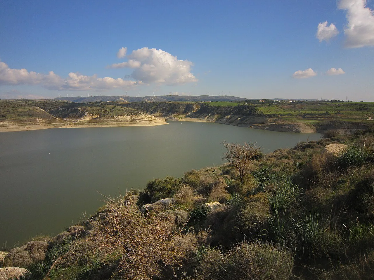
The dam itself: height, type and completion year
The structure is 110 metres high and built of concrete, a gravity design set across the valley below the reservoir. The scale is best understood from the downstream side, where the wall drops away from the road level, but there is no source-supported viewing platform or marked safe stopping point on the face itself. Read the structure from the accessible road approach and keep clear of any barriers or locked gates.
Because the dam is operational infrastructure, the interesting facts are engineering ones rather than historical ones. Completion in 1984 places it in the later phase of Cyprus water planning, and its purpose is storage and supply rather than scenery. Visitors who arrive expecting ruins or a nature reserve should recalibrate: this is a working piece of national infrastructure that happens to sit in attractive countryside.
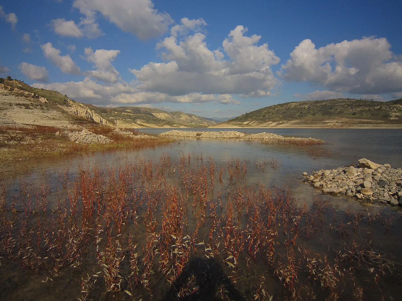
The reservoir behind it and Foinikas on its banks
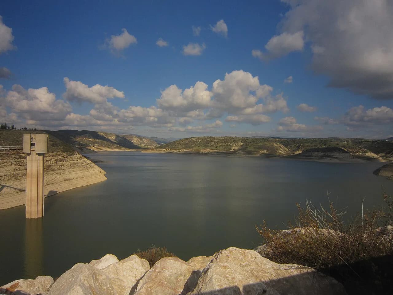
Behind the wall lies the reservoir, and on its banks sits Foinikas, an abandoned village that was historically a base of the Knights Templar. The combination is what lifts the stop above a quick photo: you have a modern dam, a shrinking or filling sheet of water depending on the season, and a deserted settlement in the same frame. Treat the village as something to look at and read about rather than something to wander through, since access arrangements are not documented anywhere official.
The water level is the single variable that changes the whole visit. When the reservoir is fuller, the valley reads as a lake and Foinikas sits close to the water; when it is lower, bare ground and the old settlement's setting become the main subject. Check the level before you commit to the drive if seeing water matters to you, and go with the expectation that the view is the point rather than any facility on site.
Getting there by car from Paphos
There is no realistic public transport option for the dam, so you need a car. The approach roads are the honest caveat: visitors describe them as tricky in parts, with a detour off the main road involved, so allow more time than a map suggests and avoid arriving after dark on a first visit. Once you are there, parking is easy and the site is straightforward to reach on foot from the car park.
Cyprus drives on the left, and the last stretch is narrow and winding enough that a smaller hire car is an easier companion than a large one. Coming from Paphos, the dam pairs naturally with Kouklia and the coast, so build it into a loop rather than a there-and-back errand. A road-trip approach of short hops between stops works better here than a single long day behind the wheel.
What you actually see: water, views and the drive
The visit is short and largely visual: the wall, the water, the valley and Foinikas across the reservoir. Visitors describe the setting as beautiful and the parking as simple, which matches the shape of the experience rather than overselling it. Come self-sufficient — bring water — and treat the stop as a landscape pause rather than a serviced attraction.
Summer changes the experience more than anything else. The Paphos district gets very hot in July and August, the dam offers little shade, and the light on concrete at midday is harsh, so early morning or late afternoon is the sensible window. In winter and spring the surrounding country is greener and the drive itself becomes the reward, though the roads are the same narrow ones either way.
Fishing and walking at the reservoir
Fishing is a common reason people search for this reservoir, but the rules, licences, seasons and permitted spots are set by the responsible authorities and are not published in any form you can rely on from a general guide. Sort that out before travelling rather than at the water's edge: ask the Water Development Department, which oversees the island's dams, what applies at Asprokremmos and whether access to the bank is allowed at all.
There is no documented waymarked walk around the reservoir, so do not plan a circuit on the assumption one exists. A short look from the road and car park is the realistic activity, and any longer walking should be treated as an unverified extra to confirm locally. The same caution applies at other island reservoirs such as Germasogeia dam, where access is similarly a matter of official permission rather than a published trail.
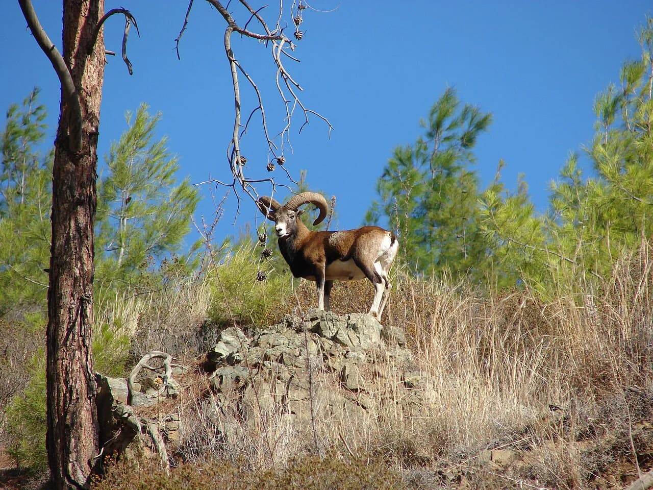
If wildlife is your reason for coming, set expectations low and rewards high: the reservoir and its surroundings are ordinary Cypriot countryside, and the island's headline species are covered in the guide to Cyprus wildlife. The Cyprus mouflon, for instance, keeps to forested mountain slopes rather than dam walls, so a stop here is not a substitute for a Troodos day.
Is it worth a stop on a Paphos itinerary?
Yes, if you are already driving inland from Paphos and want thirty to sixty minutes of landscape with a story attached; no, if you are choosing between this and the Paphos mosaics or Kourion on a tight schedule. The dam works as a leg on a loop that takes in the coast and the Paphos hinterland, and it works far less well as a standalone outing. Budget for the drive, not for the site. For the wider picture of how the island stores water, see the guide to Cyprus Dams.
Comparing it with other reservoirs helps set the bar. Evretou dam, in the north-west of the Paphos district, is the other obvious water stop for drivers touring this corner of the island, and both offer the same trade-off: open-air scenery, a simple roadside stop, and a view that depends entirely on the water level that year.
Should you add the dam to your Paphos drive?
Add Asprokremmos Dam to a Paphos driving day if you want a short landscape stop with a striking piece of 1980s engineering and the abandoned village of Foinikas in view. Skip it if your time is better spent on the archaeological sites, or if narrow approach roads and a lack of on-site facilities would spoil the day. The water level decides how good the view is, so treat the stop as a bonus rather than the reason for the journey.
Frequently Asked Questions
How tall is Asprokremmos Dam and when was it completed?
The dam is 110 metres high and was completed in 1984. It is a concrete gravity dam, meaning it holds the water back through its own weight rather than an arched profile.
What is there to see at Asprokremmos Dam?
The dam wall, the reservoir behind it and the abandoned village of Foinikas on its banks. Visitors describe the setting as beautiful and parking as simple, but there are no attractions or services at the dam itself, so plan a short stop.
Can you walk around Asprokremmos Reservoir?
No waymarked circular walk around the reservoir is documented, so plan on a short stop near the dam wall and car park. Any longer walking or bank access — including fishing — needs confirming with the Water Development Department before you go.
Sources
Notes for your Cyprus trip
Optional updates to our Cyprus guides.
You might also like
Continue reading
More guides you'll find useful